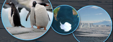
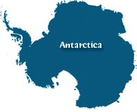
Antarctica's Location and Geography
Imagine flying in a plane over Antarctica, the southernmost continent and the coldest and driest region on earth. From the air, you see that it covers a huge area, about 14 million square kilometers (5.4 million square miles), about half the size of the United States. Antarctica is just slightly larger than another continent in the southern hemisphere, Australia.
You also see that it is quite mountainous. Antarctica has an average elevation of 2,300 meters (7,500 feet) making it the highest continent on Earth. In comparison, the average elevation of the state of Colorado (the highest in the USA) is a mere 6,800 feet.
As your plane circles over the landscape, you note that Antarctica is divided into unequal eastern and western portions by the Transantarctic Mountain chain, which is about 100 million years old. East Antarctica is a platform about 488 meters (1,600 feet) above sea level, composed of rocks more than 550 million years old, with younger rocks on top.
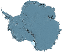
West Antarctica lies south of South America. The land in West Antarctica is lower than in the east, and in some places is even well below sea level. The continent’s highest peak, Vinson Massif, is found in West Antarctica. It is located on the coast and is 4,876 meters (16,000 feet) tall.
Under the surface of Antarctica, all is not cold and quiet. In fact, there is an active volcano in Antarctica: Mount Erebus, which is 3,794 meters (12,447 feet) in height, is located in East Antarctica, on the edge of the Ross Ice Shelf—a place where ice extends far out over the ocean.
Antarctica is also home to Lake Vostok, one of the world's largest lakes. Lake Vostok is roughly the size of North America's Lake Ontario, but it is not a lake for sailing boats. It lies 4 kilometers (2 miles) below the continental ice sheet. Its waters have been sealed from air and light under the tremendous pressure of the continental ice sheet for perhaps as long as 35 million years.
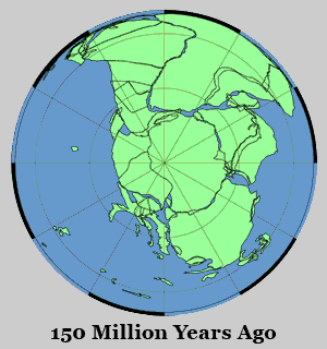 Geologic History: Antarctica was not always the frozen, dry continent it is now. Two hundred million years ago, it was the center of a “supercontinent” called Gondwana that included parts of South America, Africa, India, and Australia.
The breakup of Gondwana about 180 million years ago started the episode of continental drift that separated Africa from South America, and formed the South Atlantic Ocean.
At the same time, the Indian subcontinent started moving north, heading for Asia and the eventual uplift of the Himalayas, while Antarctica moved southward. The similarity in the types of rocks and fossils found in these southern continents helps prove the theory of continental drift.
Rocks and fossils also confirm that Antarctica was once connected to these regions, and that it was much warmer and wetter in the distant past.
The plate reconstructions shown above were derived from data made available on the ODSN-Geomar Web site.